Assets
Geology & Exploration
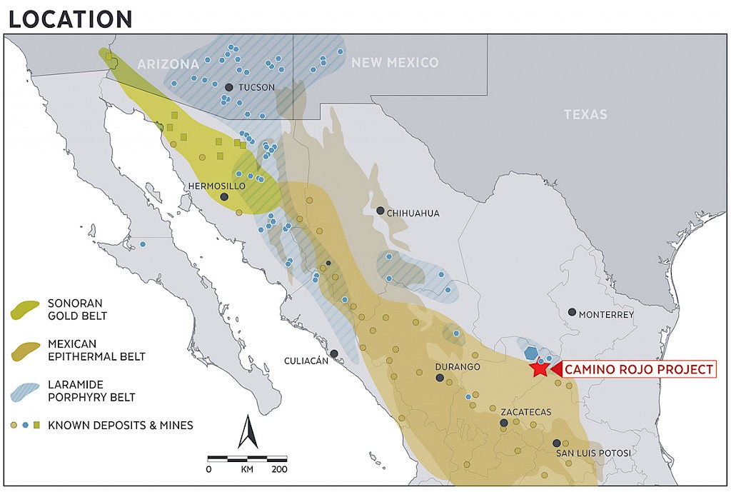
Mexico (138,636 hectares)
The land package is under-explored and the proximity to the large Camino Rojo mineralized system, hosting 9.5 million ounces gold in measured and indicated gold resources (353 million tonnes at 0.83 g/t)[1], provides a highly prospective opportunity. Exploration on the project is somewhat challenged due to the presence of a thin alluvial soil and caliche cover impacting geochemical surface expressions, but the potential to discover mineralization is considered excellent.
[1] The Camino Rojo Mineral Resource estimate has an effective date of June 7, 2019 and was prepared using the CIM Definition. Additional information can be found in the "Camino Rojo Project Feasibility Study NI 43-101 Technical Report” on this website or on SEDAR, dated January 11, 2021.
Geology
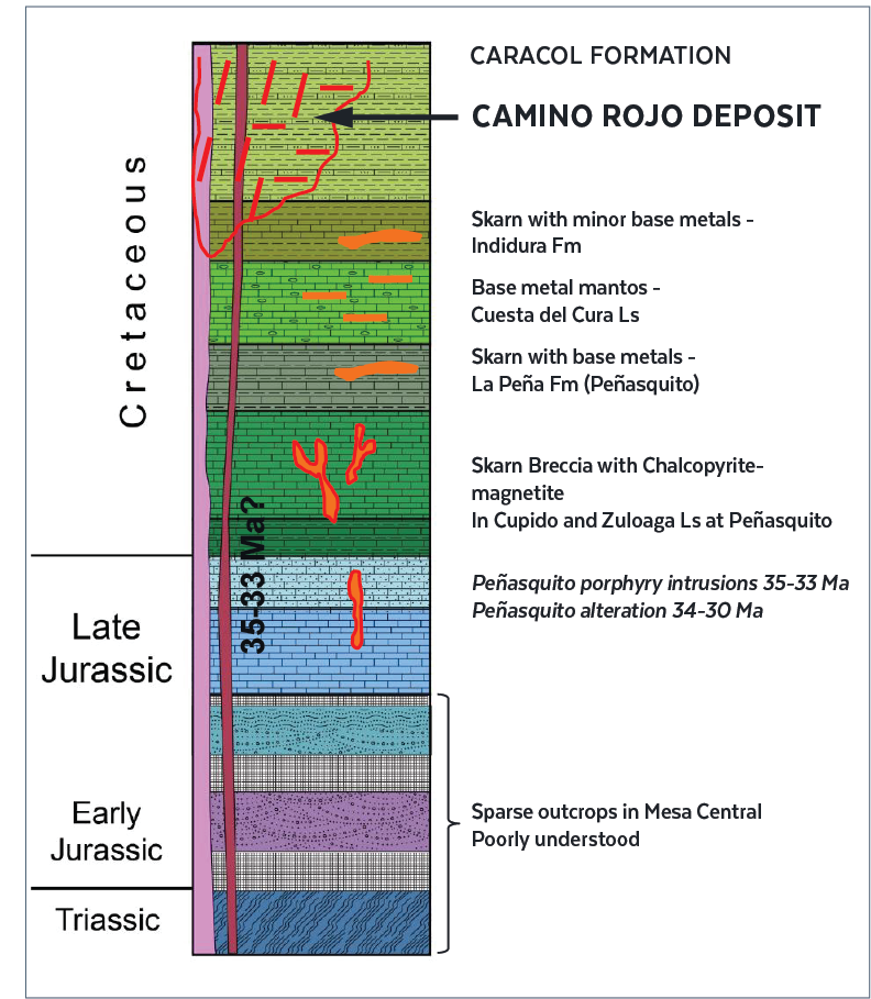
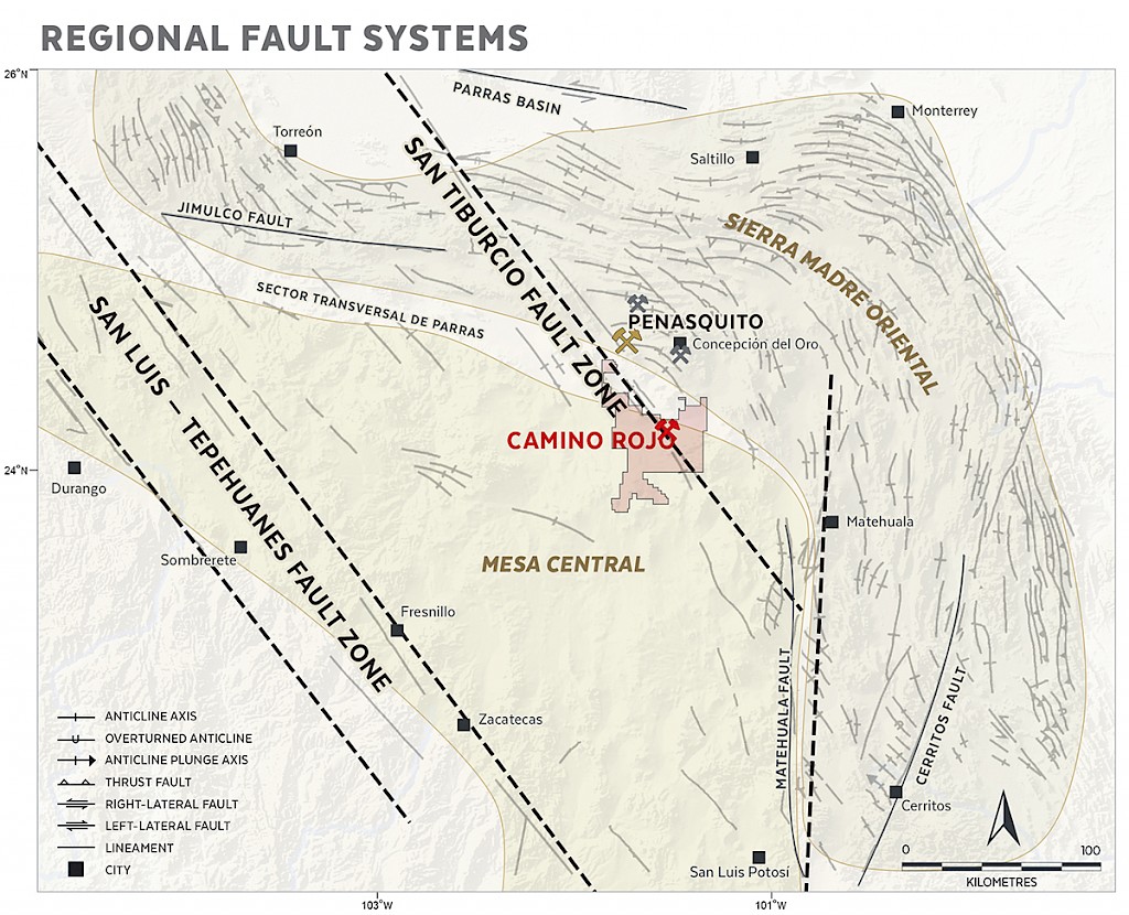
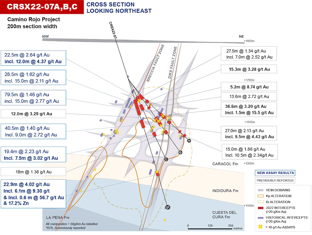
Camino Rojo is an intrusive related, polymetallic gold-silver-zinc-lead deposit hosted in clastic sedimentary rocks along the boundary between the Mesa Central physiographic province and the Sierra Madre Oriental fold and thrust belt. The deposit is situated between splays of the regional northwest trending San Tiburcio fault zone, beneath a broad pediment of Tertiary and Quaternary alluvium. This pediment is surrounded by uplands of folded marine limestone of Late Jurassic through Cretaceous ages.
The most important host to gold mineralization is the Caracol Formation, a sequence of weakly calcareous turbiditic sandstones, siltstones and shales. The underlying Indidura Formation, comprised of regularly bedded siltstones and shales, and the Cuesta del Cura limestone, recrystallized to fine-grained white marble, hosts a minor amount of polymetallic sulfides. Narrow igneous dikes intrude the sediments along linear NE-striking faults.
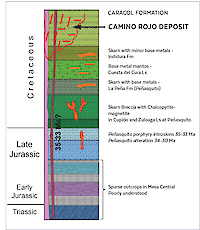
Mineralization is associated with a network of sheeted carbonate veins and breccias controlled by primary bedding and discordant structures. Vein networks are enveloped by a zone of potassic alteration with low-grade disseminated gold in pyrite. The dikes are variably mineralized and display sericitic alteration.
Pervasive near-surface oxidation extends to depths of 100 – 150m. The underlying transitional zone of mixed oxide/sulphide extends to depths of 200 to >250m and is characterized by partial oxidation along bedding and zones of fracturing. The extent of oxidation in the transitional zone is dependent on fracture intensity. The oxide halo extends up to several metres beyond fracture zones. Sandy layers are permeable and are preferentially oxidized up to tens of meters outward from fracture zones, creating a stratigraphically interlayered sequence of oxide and sulphide material at the centimetre-scale. Such robust near-surface oxidation of the Camino Rojo type deposit supports a bulk-mineable open-pit scenario.
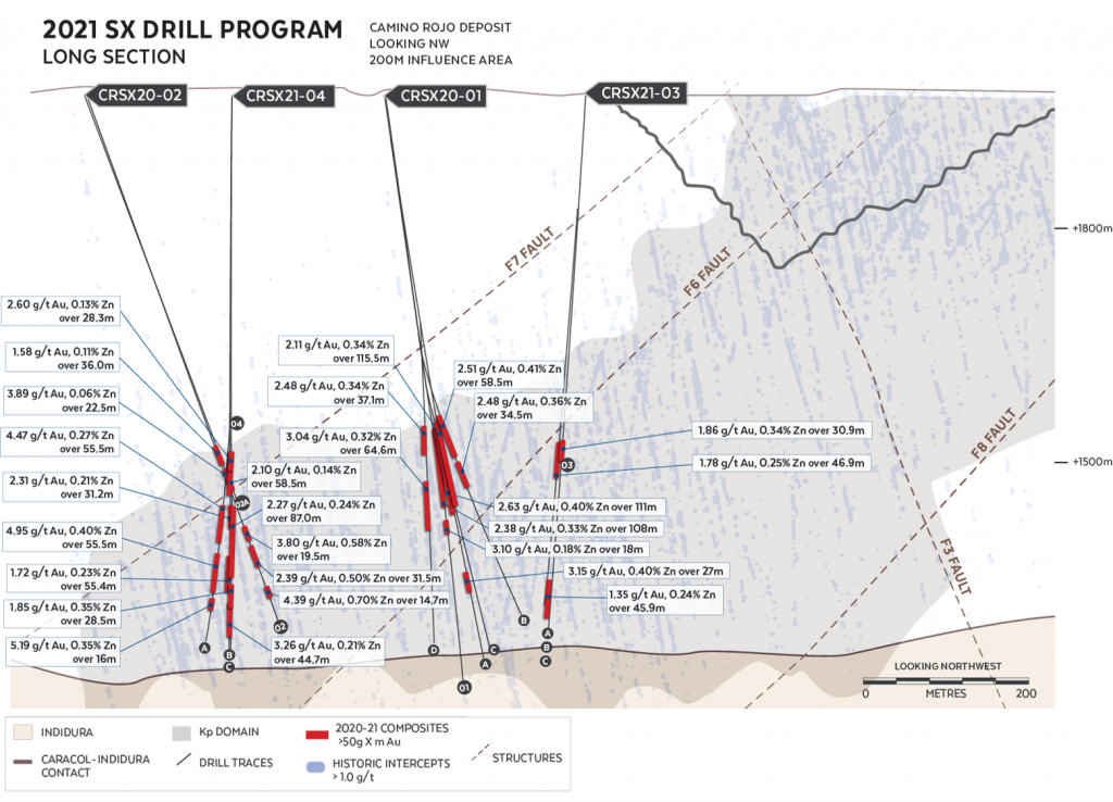
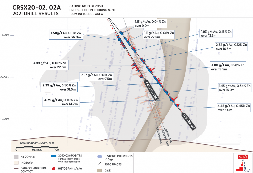
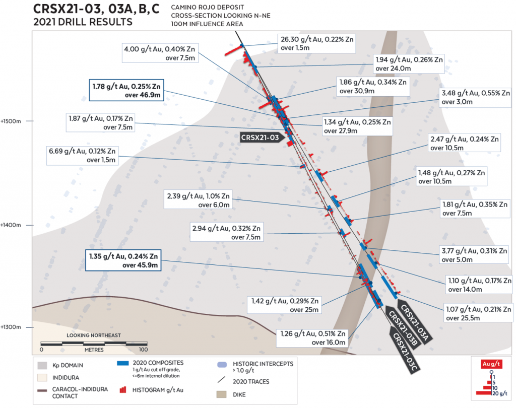
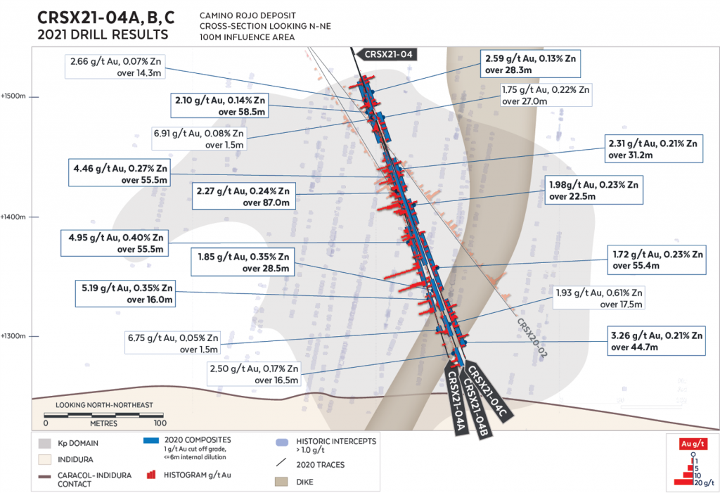
Camino Rojo Exploration
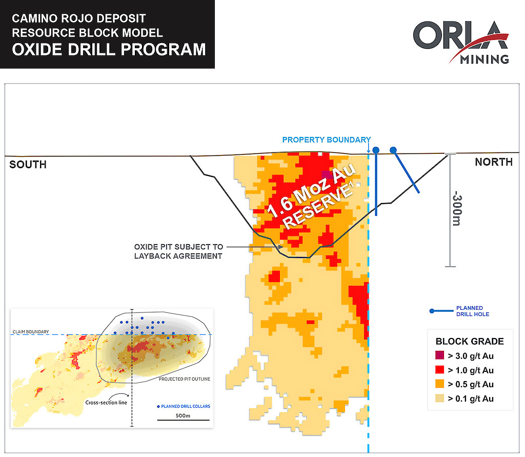
Camino Rojo Oxide Program:
The Company is seeking to define additional oxide reserves at the Camino Rojo Oxide Mine following confirmatory core drilling on the Fresnillo Plc’s (“Fresnillo”) property, located immediately north and adjacent of the Camino Rojo oxide mine open pit. While historical drilling indicates that mineralization continues across the property boundary onto the Fresnillo layback area, no ounces from this area are currently included in the Camino Rojo mineral reserve estimate. The planned 2,500m diamond drill program is designed to confirm and delineate mineralization located in the oxide pit layback and allow for a potential update of mineral resource and reserve estimations.
Camino Rojo Regional Exploration Program:
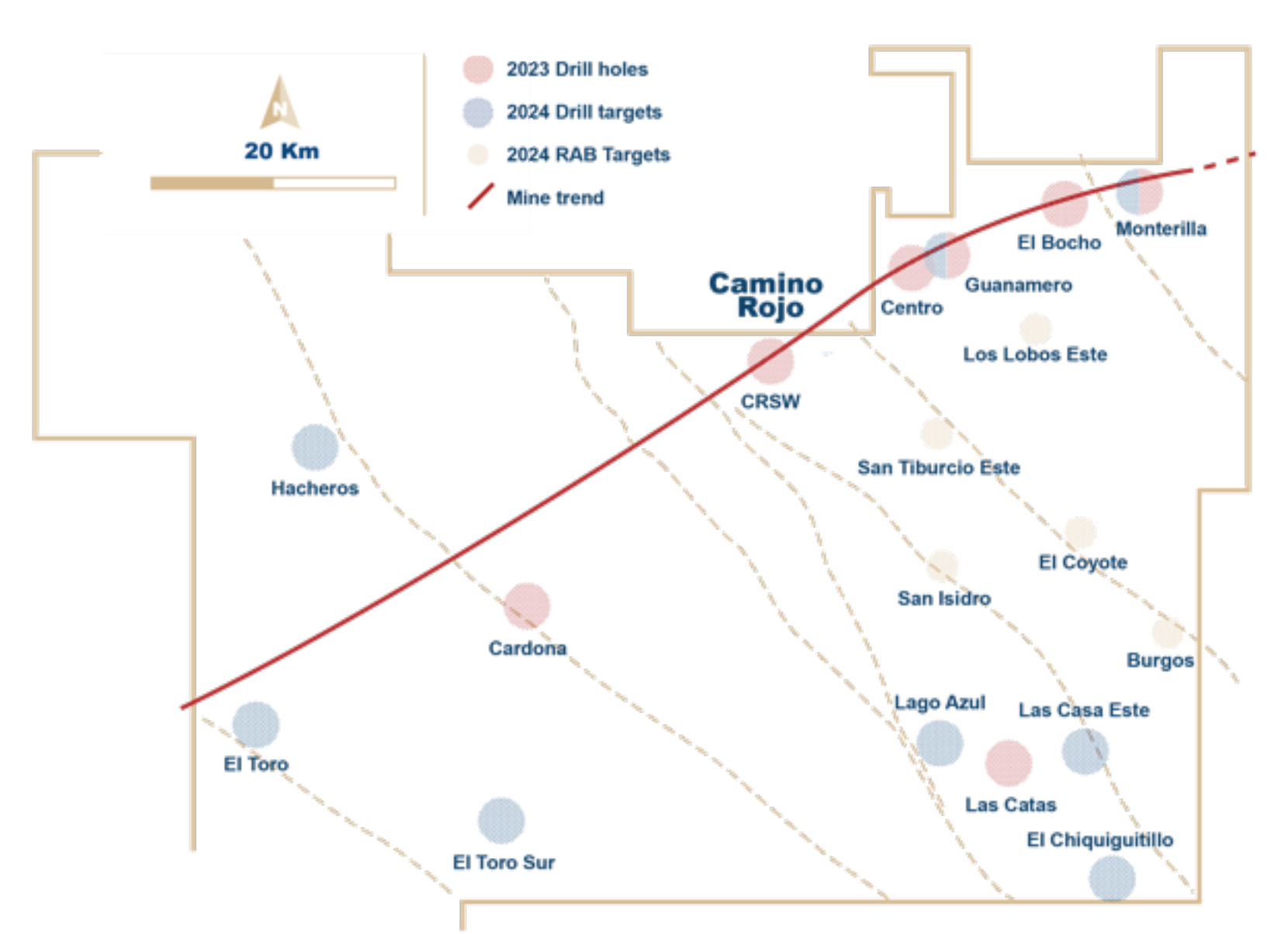
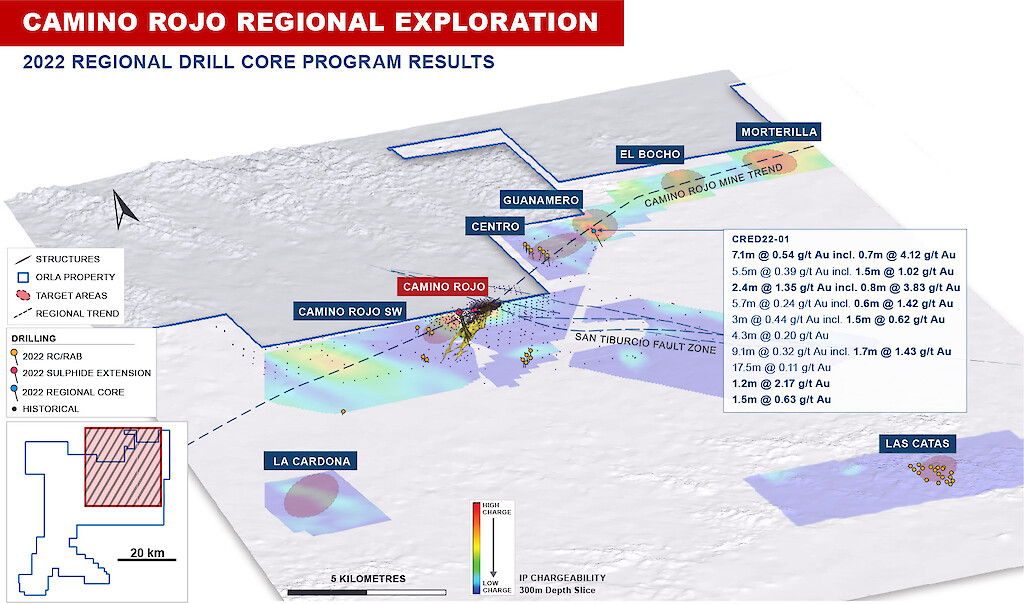
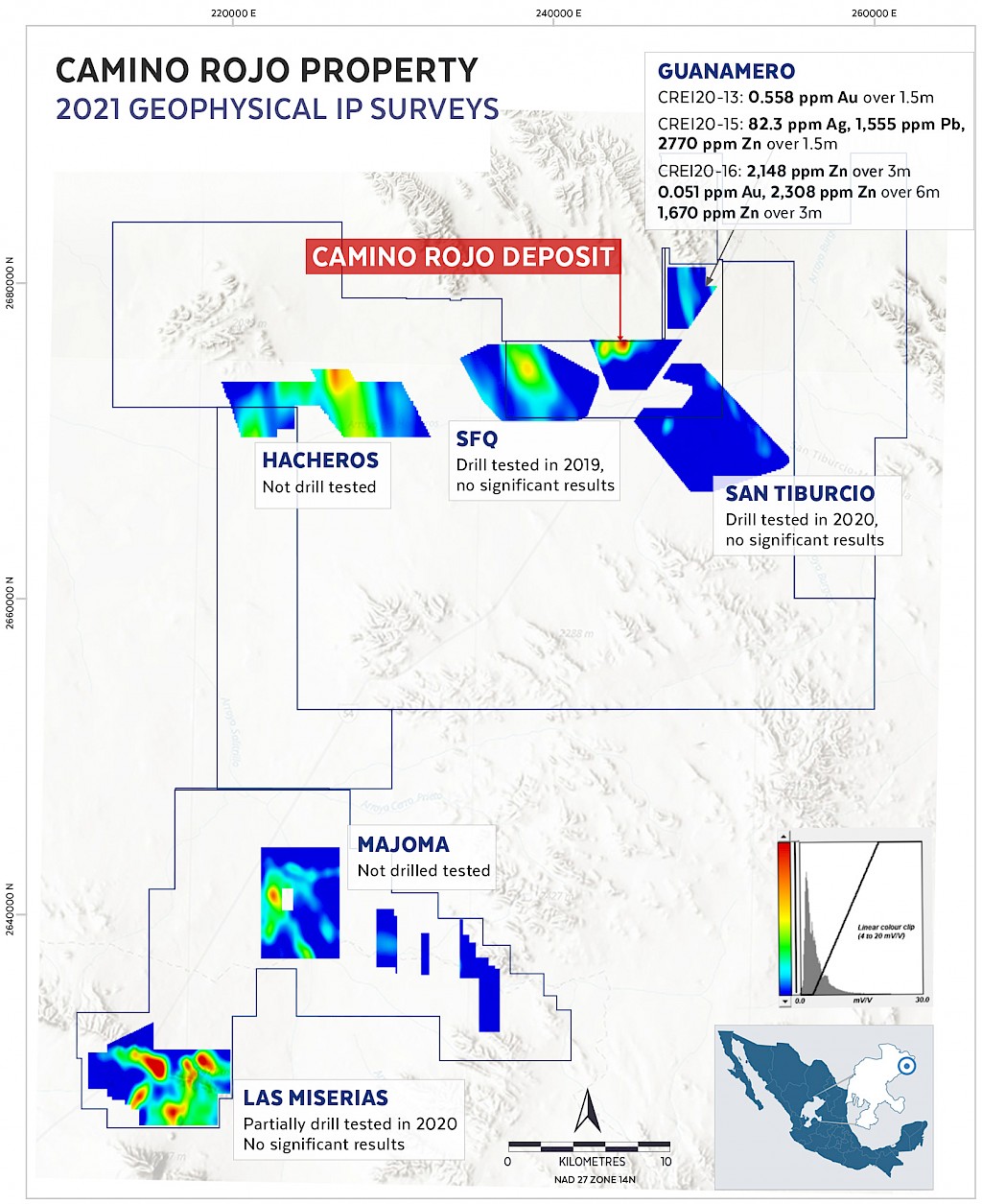
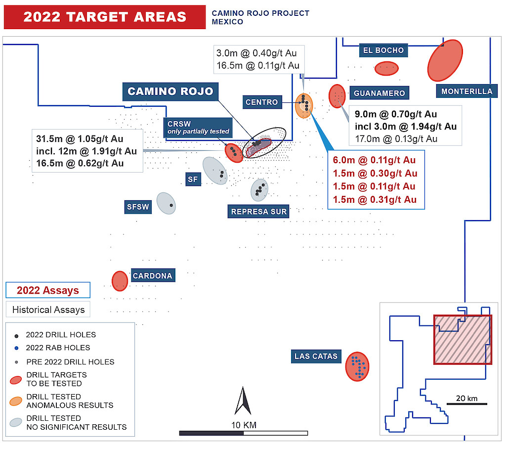
Prior to 2021, exploration had focused on defining and expanding the Camino Rojo deposit, with limited work outside the area of the currently defined deposit and infrastructure. In 2021, regional exploration focused on defining new exploration targets using detailed airborne magnetic drone survey, induced polarization (IP) survey, and multi-elements soil geochemistry. In addition, a 9,146m, 284-hole regional rotary air blast (RAB) Cover-Bedrock Interface (CBI) program, with drill fences spaced at 1,000m and drill holes spaced at 500m along the fence, was completed to directly sample bedrock below shallow cover. Encouraging results of anomalous gold were intercepted, including 3m at 1.94 g/t Au and 44m at 0.08 g/t Au, 7 km northeast of Camino Rojo (see figure below). See Appendix for a summary of the anomalous results from the RAB CBI 2021 drill program.
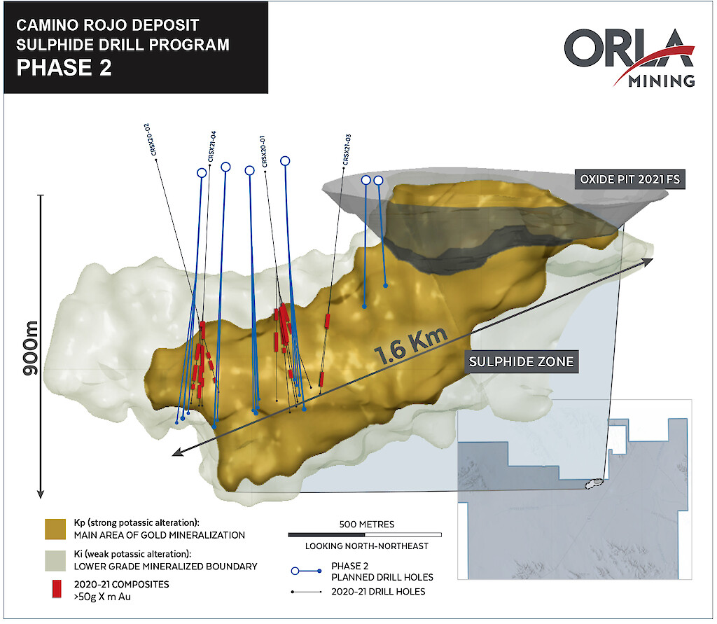
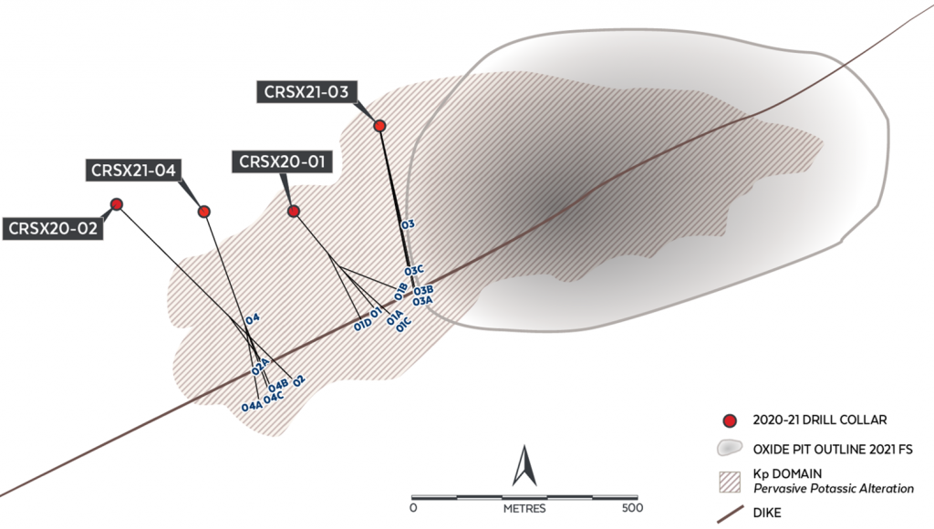
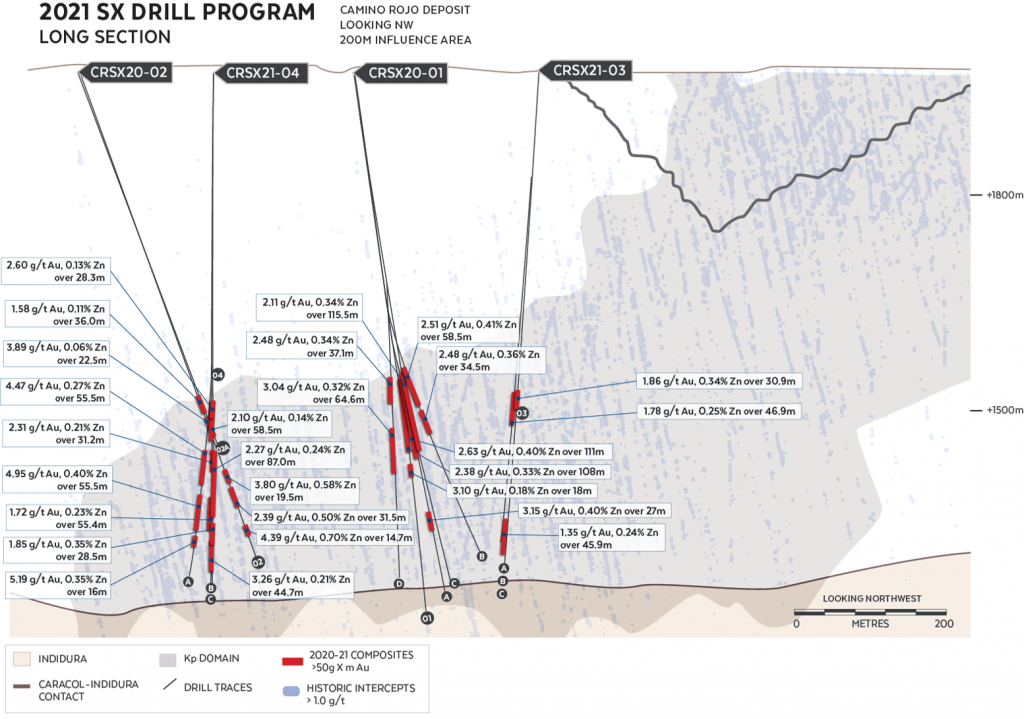
As a result of this work, several exploration targets were defined along the Camino Rojo trend and south of the Camino Rojo Oxide Mine. These new exploration targets are hosted in rocks of the Caracol or Indidura formations, are supported by geophysical and/or geochemical anomalies, and are located at the intersection of NW-SE structures associated with the San Tiburcio Fault Zone and NE-SW trending structures on or paralleling the Camino Rojo trend. In 2022, drilling will occur on priority targets and new target generation work will also continue. A 10,000m RC drill program is planning to test the priority targets along the Camino Rojo trend and south of the Camino Rojo Oxide Mine. New deposit discovery remains the objective and this could include oxide deposits that support extension of the mine life at the Camino Rojo Oxide Mine or be additional sulphide deposits that strengthen and expand the already impressive sulphide endowment.
Targeting New Discoveries
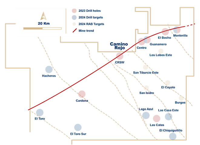
Regional exploration in 2023 consisted of 13,535 metres of drilling to test priority exploration targets along the northeast-southwest mine trend and northwest-southeast regional structural trend. Orla resumed drilling at the Guanamero target area in early 2023, completing 7,464 metres of core drilling in nine drill holes in the first half of the year. In the second half of 2023, Orla focused on drill testing other targets along the mine and regional trends. Target generation and development activities, including airborne drone magnetic and ground gravity geophysical surveys, geochemical sampling, and mechanical trenching were also completed in 2023.
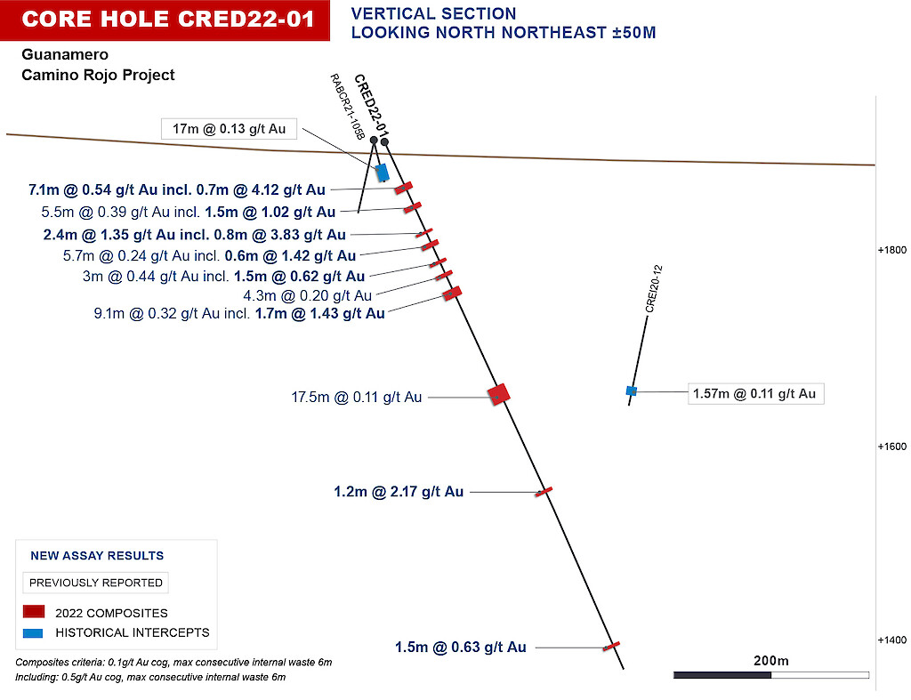
- Guanamero Target, approx. 7km NE of Camino Rojo
- 1.3m @ 61.2g/t Au – visible gold
- 10.5m @ 0.69g/t incl. 1.5m @ 4.02g/t – visible gold
- 7.10m at 0.54g/t (incl. 0.7m at 4.12g/t)
See full drill results table from Guanamero (Table 2)
In 2024, Orla has allocated approximately 13,400 m of drilling to regional exploration efforts with the objective of continuing to drill test priority exploration targets along the northeast-southwest mine trend and northwest-southeast regional trend. In addition to drill testing, target generation and development activities will continue.
- Guanamero Target, approx. 7km NE of Camino Rojo
Maps and Sections
- Stratigraphic Column References:
- Barboza-Gudiño, J., Zavala-Monsiváis A., Venegas-Rodríguez, G., Barajas-Nigoche, D., 2010
- Enriquez, E., 2010
- Ortega-Flores, B., Solari, L.A., Escalona-Alcazar, F., 2015
- Nieto-Samaniego, A.F., Alaniz-Álvarez, S.A., and Camprubí, A., 2007
- Sanchez, S., 2017